Leica Geosystems – Coastal & Shallow Water Mapping via Bathymetric LiDAR
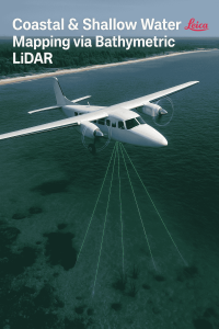
Leica Chiroptera 4X
-
The Chiroptera 4X combines bathymetric (green laser) and topographic (near-infrared laser) LiDAR in one seamless system, capturing data both above and below water. It processes full-waveform returns and delivers outstanding point density.
-
It boasts a bathymetric point capture rate of 140,000 points per second, penetrating shallow waters down to 25 m, even in turbid conditions.
-
Compared to its predecessor (Chiroptera II), the 4X offers a 4× increase in resolution, improving both depth penetration (up to ~10%) and overall accuracy—without sacrificing data quality.
-
Operational efficiency increases dramatically: a single flight line now suffices (instead of double coverage), enabling cost savings of over 50% in flight operations.
Cape John Peninsula, Canada – Environmental & Aquaculture Mapping
Challenges Overcome
Traditional methods like aerial photography or boat-based echo sounding were costly, weather-dependent, and hindered by water clarity issues.
Objectives and Approach
Dr. Tim Webster and his team from the Applied Geomatics Research Group (AGRG) deployed the Chiroptera 4X to:
-
Map benthic habitats, aquaculture infrastructure (e.g., shellfish farms, buoys), and estimate biomass.
-
Develop a hydrodynamic model to guide the placement of new oyster farm leases—ensuring eelgrass (Zostera marina) habitats remained protected.
Download Sample Copy of Report@ https://www.precedenceresearch.com/sample/6683
Performance Comparison
A comparative experiment assessed sensor performance at different depths using:
-
Chiroptera II
-
Chiroptera 4X
-
A multibeam echosounder
They surveyed submerged targets—four one‑cubic‑metre cubes—and analyzed results based on:
-
Point cloud density
-
Orthophoto mosaics
-
Digital elevation models (DEMs)
-
LiDAR amplitude data
Findings
-
The Chiroptera 4X delivered significantly higher point density, refined detail, and improved detection limits even revealing seabed features missed by prior surveys.
-
The combined laser approach enabled precise 3D mapping of underwater structures and habitats.
-
Generated models and elevation maps supported actionable insights on habitat preservation and sustainable aquaculture site planning.
Dr. Webster noted the system’s value across hydrography, marine ecology, and archaeology applications.
Tonga Islands, South Pacific – Nautical Charting & Marine Safety
-
This region presents significant charting challenges due to its cultural and navigational complexity—many areas remain under-mapped, complicating safe navigation, infrastructure development, and coastal planning.
-
Leica partnered with iXBlue, Geomatics Data Solutions (now Woolpert, Inc.), and EOMAP Australia to conduct a large-area LiDAR survey of the archipelago, generating precise 3D water depth (bathymetry) data to update nautical charts and support marine infrastructure efforts.
-
The system’s ability to capture high-density, accurate seabed data helped fill critical data gaps in the Pacific’s navigational datasets.
Why This Case Study Matters
| Aspect | Highlight |
|---|---|
| Technological Leap | 4× point density, deeper penetration, seamless topography-to-bathymetry capture |
| Operational Efficiency | >50% reduced flight costs and streamlined data collection |
| Environmental Stewardship | Eelgrass habitat protection, ecosystem health mapping, sustainable aquaculture planning |
| Navigation & Infrastructure | Enhanced charting for Pacific regions supports safer and more informed marine development |